🚚 Free Worldwide Shipping on All Orders!Shop Now
An Historical Map and Plan of the Campaign in Belgium. A.D. 1815.
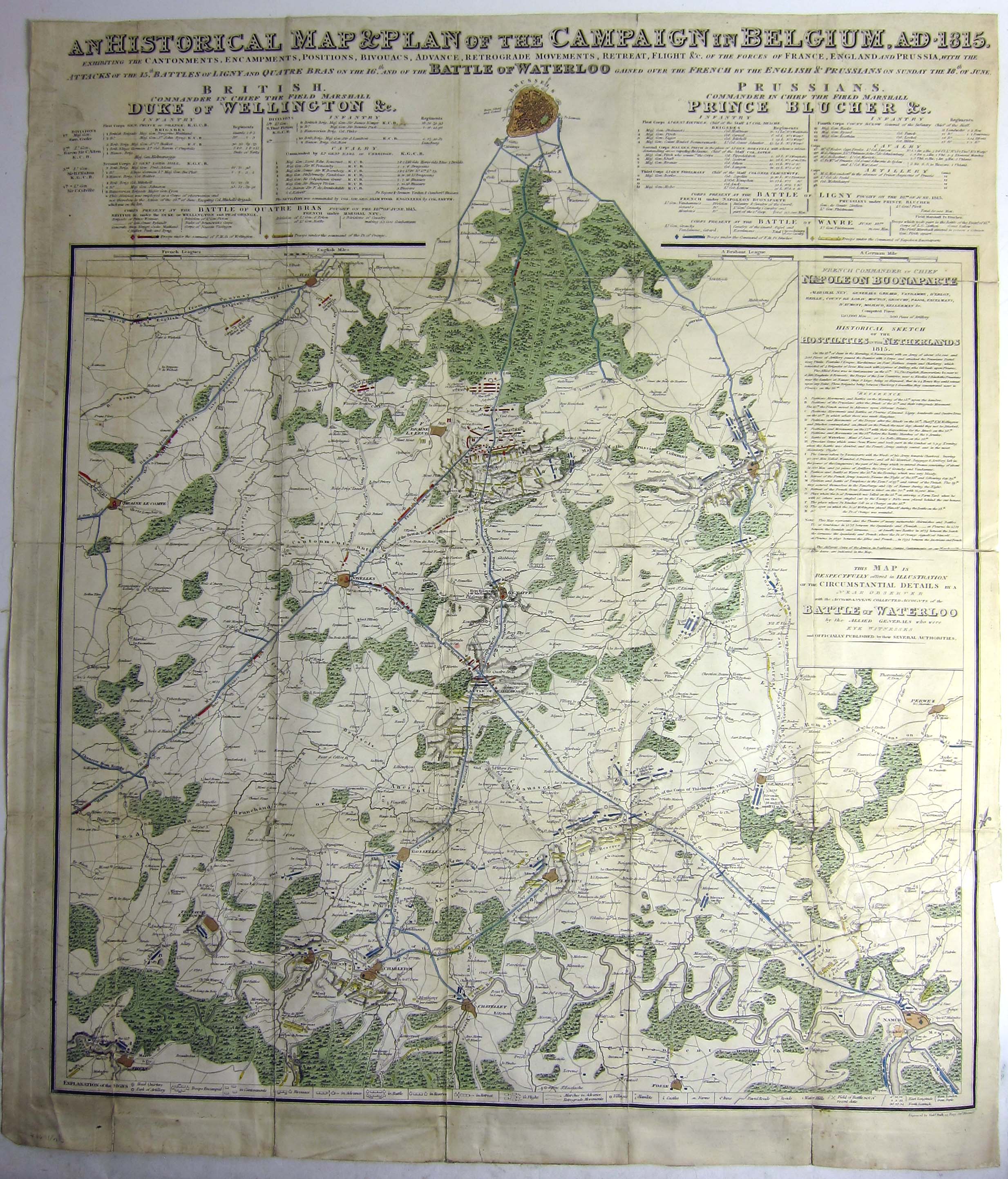
A rare and informative map separately published, showing the area comprised between Brussels and Namur where Napoleon fought his last battle, at Waterloo. It includes a key to the commanders and armies of France, Prussia and England, and the Battles of Quatre Bras, Ligny, and Wavre, with a 'Historical Sketch of the Hostilities in the Netherlands'.
Some tears along old folds, one longer closed tear repaired. Coloured in outline. Dimensions: 720 × 620mm. (28.25 × 24.25 inches).
BLMC Maps 31015.(5.)
Some tears along old folds, one longer closed tear repaired. Coloured in outline. Dimensions: 720 × 620mm. (28.25 × 24.25 inches).
BLMC Maps 31015.(5.)
$502.52
Original: $1,675.08
-70%An Historical Map and Plan of the Campaign in Belgium. A.D. 1815.—
$1,675.08
$502.52Product Information
Product Information
Shipping & Returns
Shipping & Returns
Description
A rare and informative map separately published, showing the area comprised between Brussels and Namur where Napoleon fought his last battle, at Waterloo. It includes a key to the commanders and armies of France, Prussia and England, and the Battles of Quatre Bras, Ligny, and Wavre, with a 'Historical Sketch of the Hostilities in the Netherlands'.
Some tears along old folds, one longer closed tear repaired. Coloured in outline. Dimensions: 720 × 620mm. (28.25 × 24.25 inches).
BLMC Maps 31015.(5.)
Some tears along old folds, one longer closed tear repaired. Coloured in outline. Dimensions: 720 × 620mm. (28.25 × 24.25 inches).
BLMC Maps 31015.(5.)